Note: Topo Maps+ CarPlay can only use routes created using existing, selectable “trails” (backroads) available on the US Forest Service Road overlays. It is not intended for street/highway navigation but for backroads usually to navigate to a trailhead.
To create a Driving Route for CarPlay, open Topo Maps+ in your iPhone.
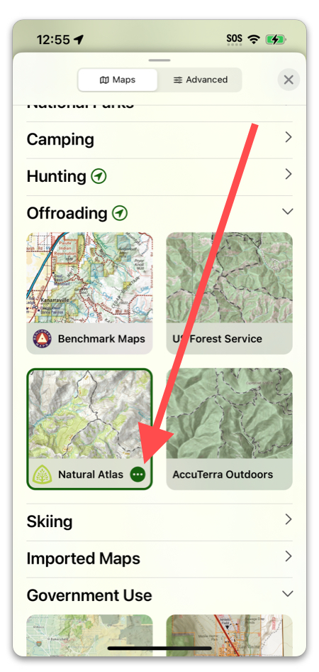
If you have Offroading as one of your selected activities in Topo Maps+, you can go to the “Maps” tab and select one of the maps under Offroading. These preset maps include the USFS roads and USFS MVUM overlays. To choose which one it displays, tap on the 3 dots icon.
If you don’t have this activity as a favorite or want to customize your map more, scroll down to the bottom of the article to learn an alternate way to set this up. You can add Offroading as an activity by scrolling to the bottom of the Maps menu.
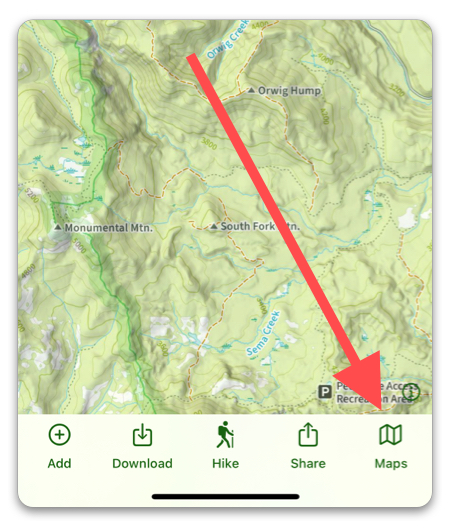
Once you have your overlay selected, find the road you are going to be driving on and tap the “Add” button, then select “Add a Route”.
Select the “Trace with Snap to Trails” method.
Then trace the US Forest Service road to your trailhead.
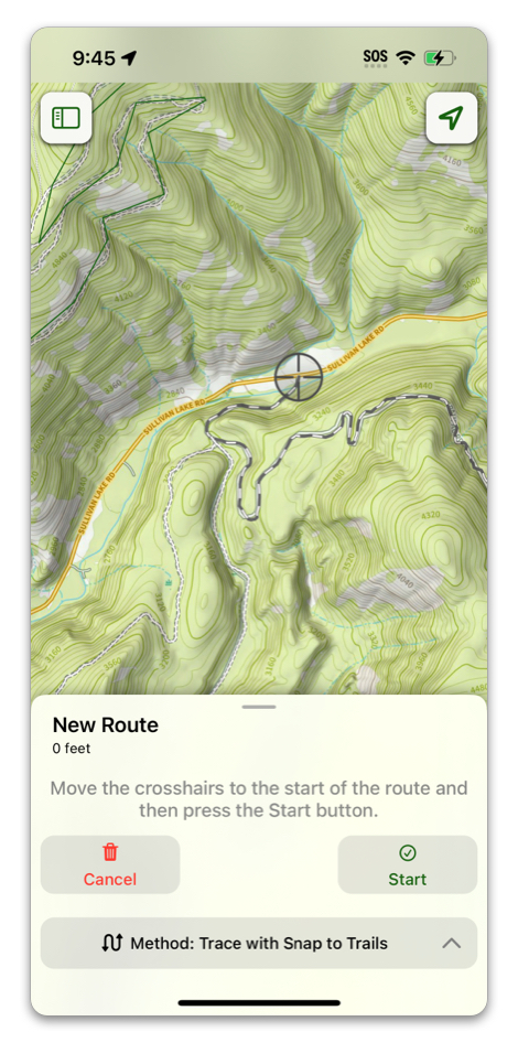
Note: While you do have to snap your route to a USFS road, your route does not have to be only that road. As long as it contains a section of a USFS road, you can switch to a different route drawing method such as freehand if you need to to finish the route to the trailhead, or connect two existing roads that have a gap between them.
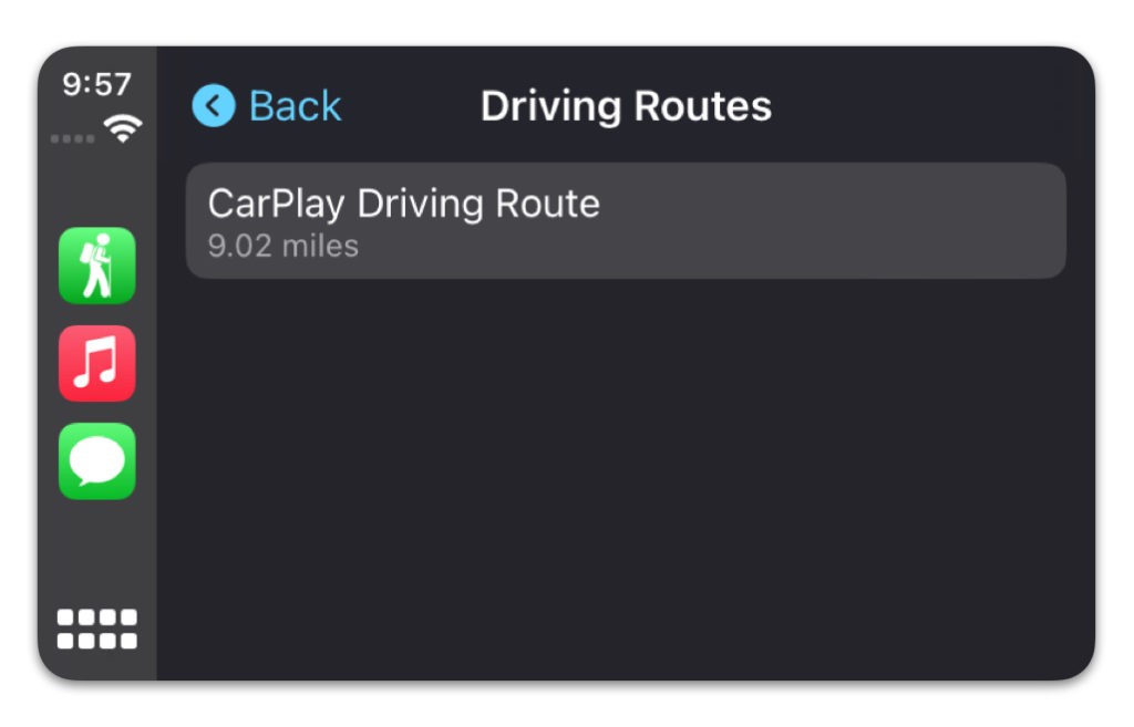
Once you have your route saved, you can select it in the CarPlay app by tapping on the “Driving Routes” button.

Select the route.
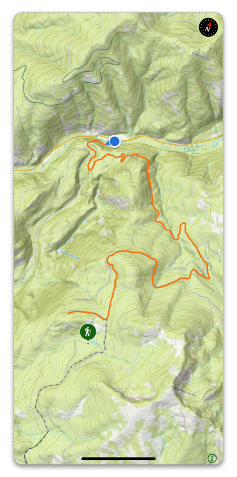
Once your route is selected, the screen should look like this:
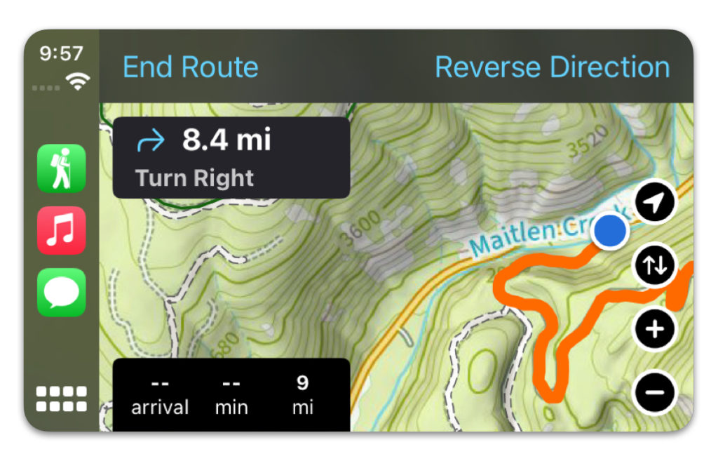
You can tap “Reverse Direction” for the drive out after the trip.
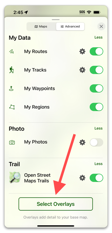
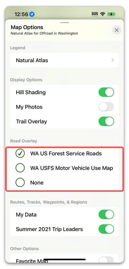
Enabling Road Overlays in the Advanced Tab:
Tap the folded map icon and select the “Advanced” tab.
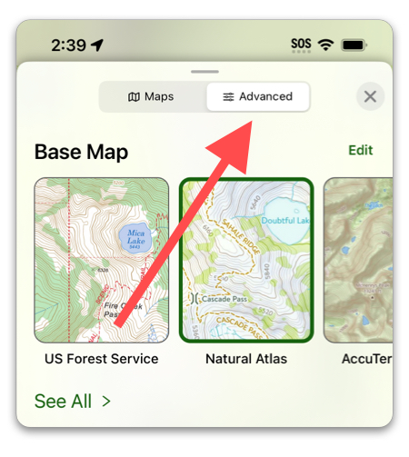
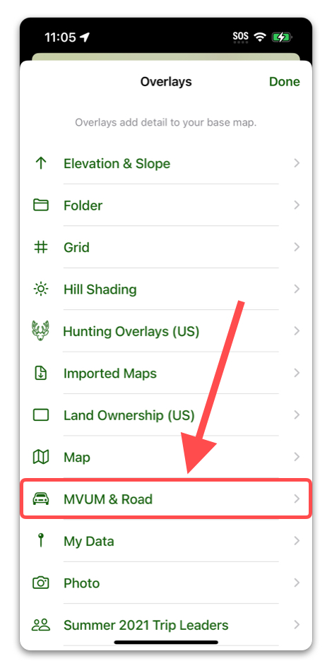
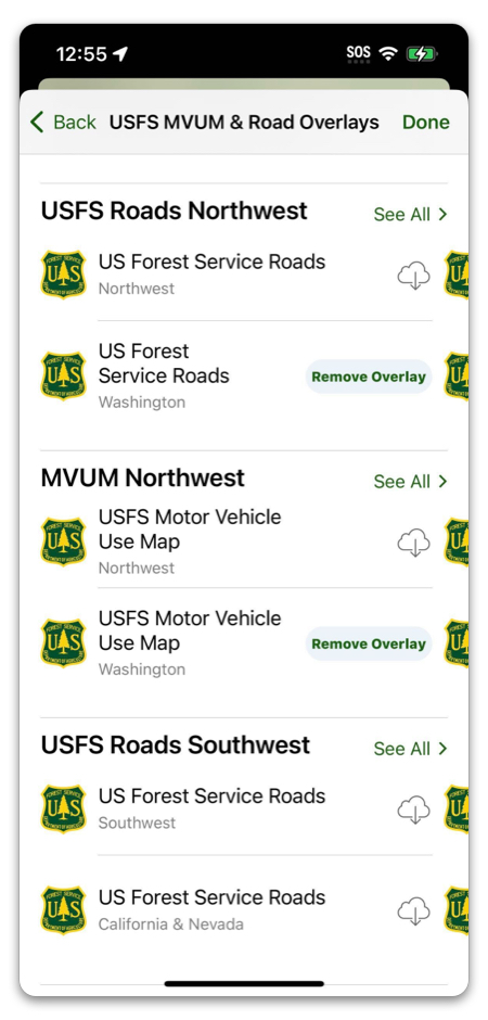
Scroll down to “Select Overlays”, then select “MVUM & Road”, then select a US Forest Service Road overlay that corresponds to your area.